
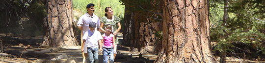
The weather is starting to cool down as the seasons change. This can be a great time to get outdoors and explore some of the local trails in our area. You can even turn it into a scavenger hunt with the kids to make it a fun learning adventure too. We've put together a list of the local trails in our area as well as an interactive map to help you find trails close to home. There are trails in our area for all abilities, both paved and non-paved so you'll be able to find something that works for your family including your fur babies too ❤️.
Make sure to pack ample water, some snacks and wear good walking/hiking shoes. Also, keep an eye on the weather so you can dress appropriately or avoid the trails altogether if it is too wet or there is a threat of wild fires in the area of the trail you are headed to. Make sure to stay on the trails. Most trails will also give you a heads up of any wild life you may come across at the beginning of the trail. Make sure to pay attention to these before entering a trail. Most wild life in our areas will avoid humans anyway but are often more active in the later afternoon hours. As a good practice, always tell someone what trail you’re going on before you go 😊.
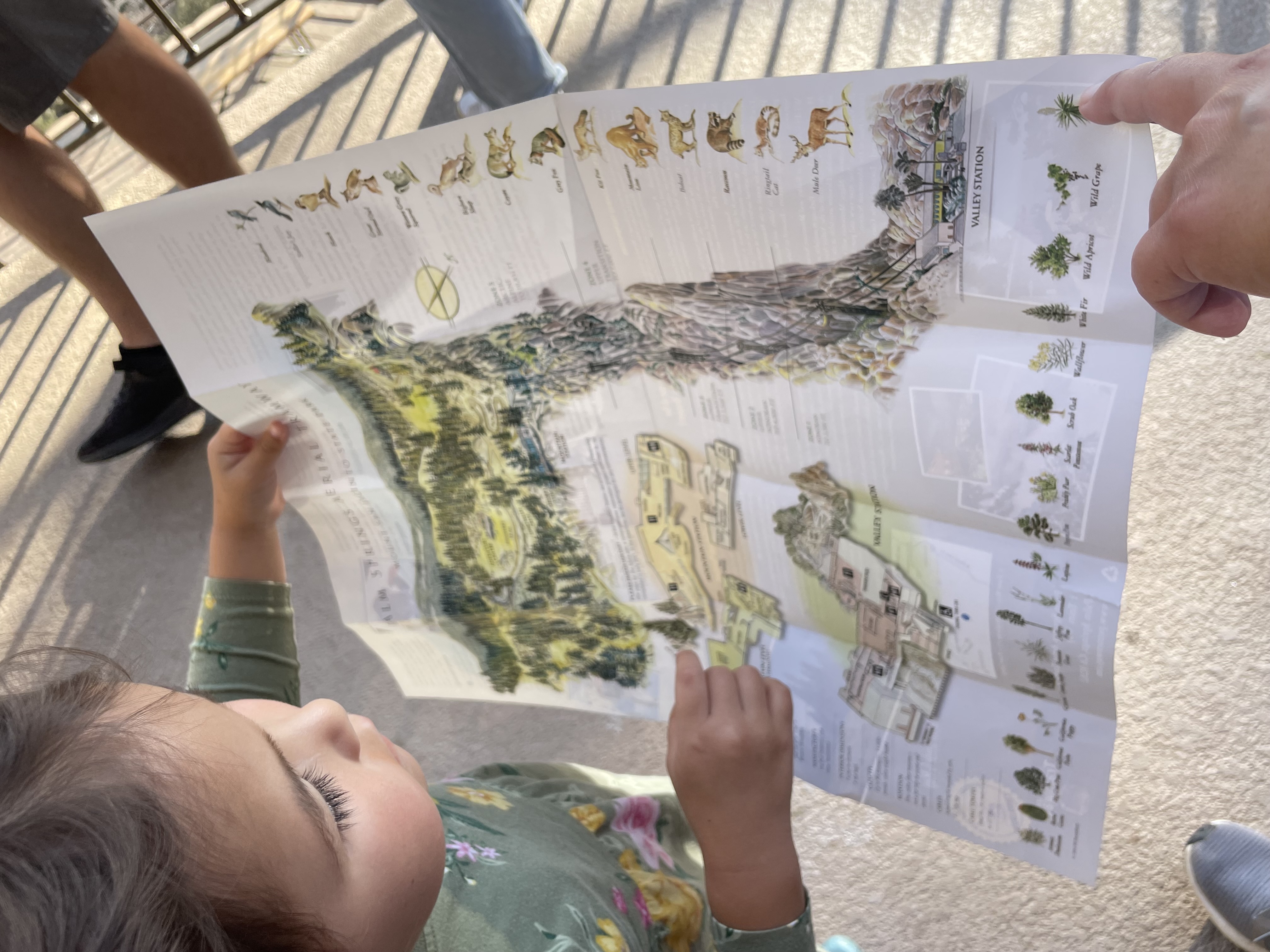
| Thank you to our Guide Sponsor, Palm Springs Aerial Tramway! |
Palm Springs Aerial Tramway is open all year round and is a great place to enjoy all the different seasons and all the outdoor fun they have to offer. During the fall, there are some amazing trails both easy and more difficult that go through Mt. San Jacinto State Park.
Long Valley Discovery Trail
Follow the nature trail posts around a ¾ mile (1.2 km) loop. This easy level trail provides an excellent introduction to the Park’s plants and animals.
Desert View Trail
A 1.5 mile (2 km) loop trail leads to a number of scenic overlooks and forest views. Short climbs, moderately strenuous.
Round Valley
A 2.5 mile trail leads to picturesque Round Valley. Fairly level trails, short climbs, moderately strenuous.
Wellmans Divide
From Round Valley to Wellmans Divide is a 1-mile hike with a 600 foot elevation gain. The view from here is truly spectacular. Looking west you can see the dome of the Palomar Observatory and to the southwest Tahquitz Peak Lookout. From this point you can continue down to Idyllwild or up to the Mt. San Jacinto Peak. Elevation gain, strenuous.
San Jacinto Peak
This is a 5.5 mile hike one way and will take you to the second highest point in southern California. On clear days it is reported that you can see Catalina Island or the glow from Las Vegas at night.
For your comfort, always wear sturdy closed toe shoes, layered comfortable clothing, hat and sunscreen. A light jacket in spring and early summer, and for fall and winter, a heavy jacket and gloves are a good idea, along with appropriate waterproof shoes. Water is only available at the Ranger Station. Bring your own water if you are traveling further. Stay on designated trails only.
The State Park will charge $5 per person for camping permits. There is no fee for day hiking permits at this time.
You can get more info on ticket pricing, hours, their restaurant and more at https://pstramway.com/. If you make it up there for a visit, make sure to let them know Macaroni KID Temecula-Murrieta-French Valley sent you!
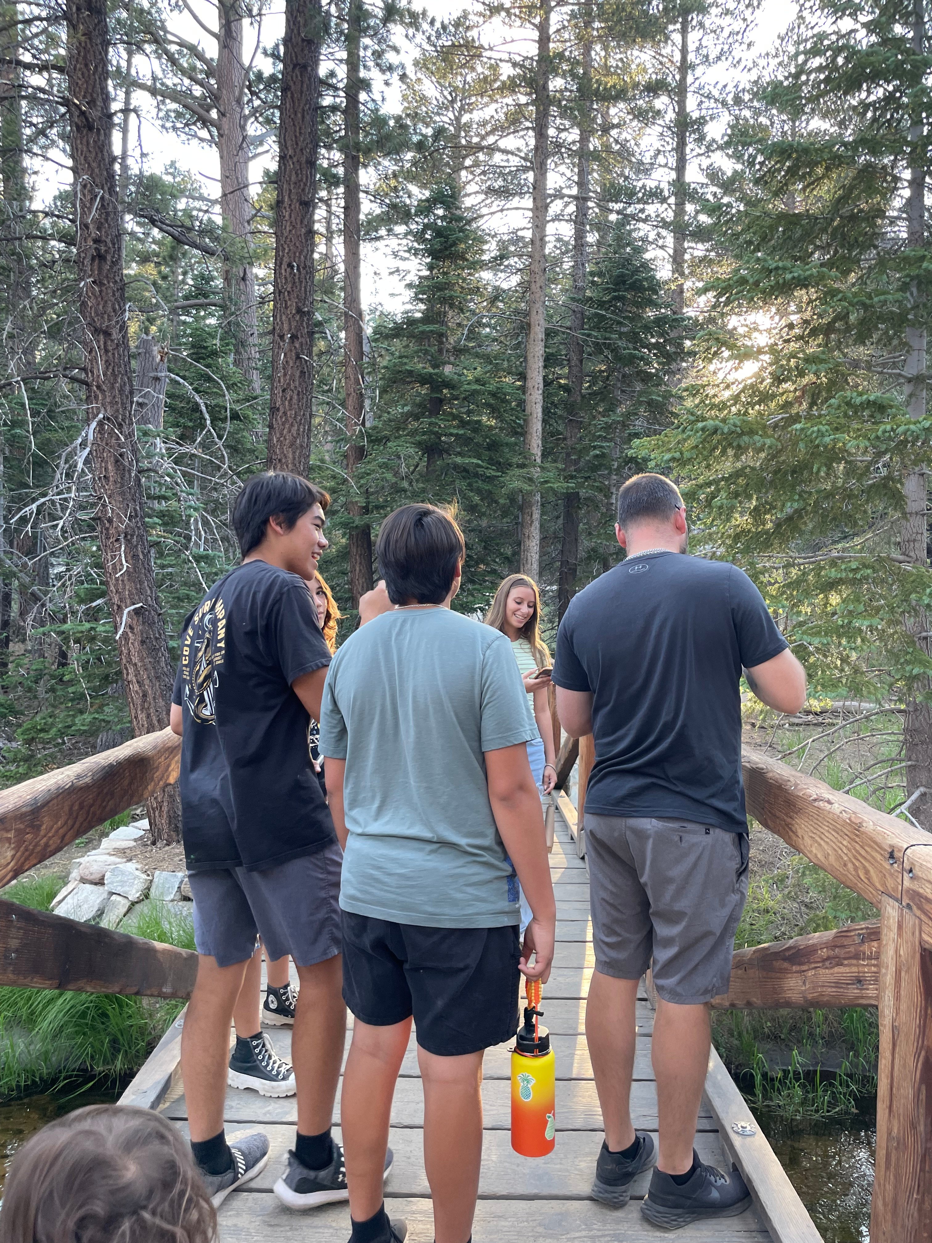
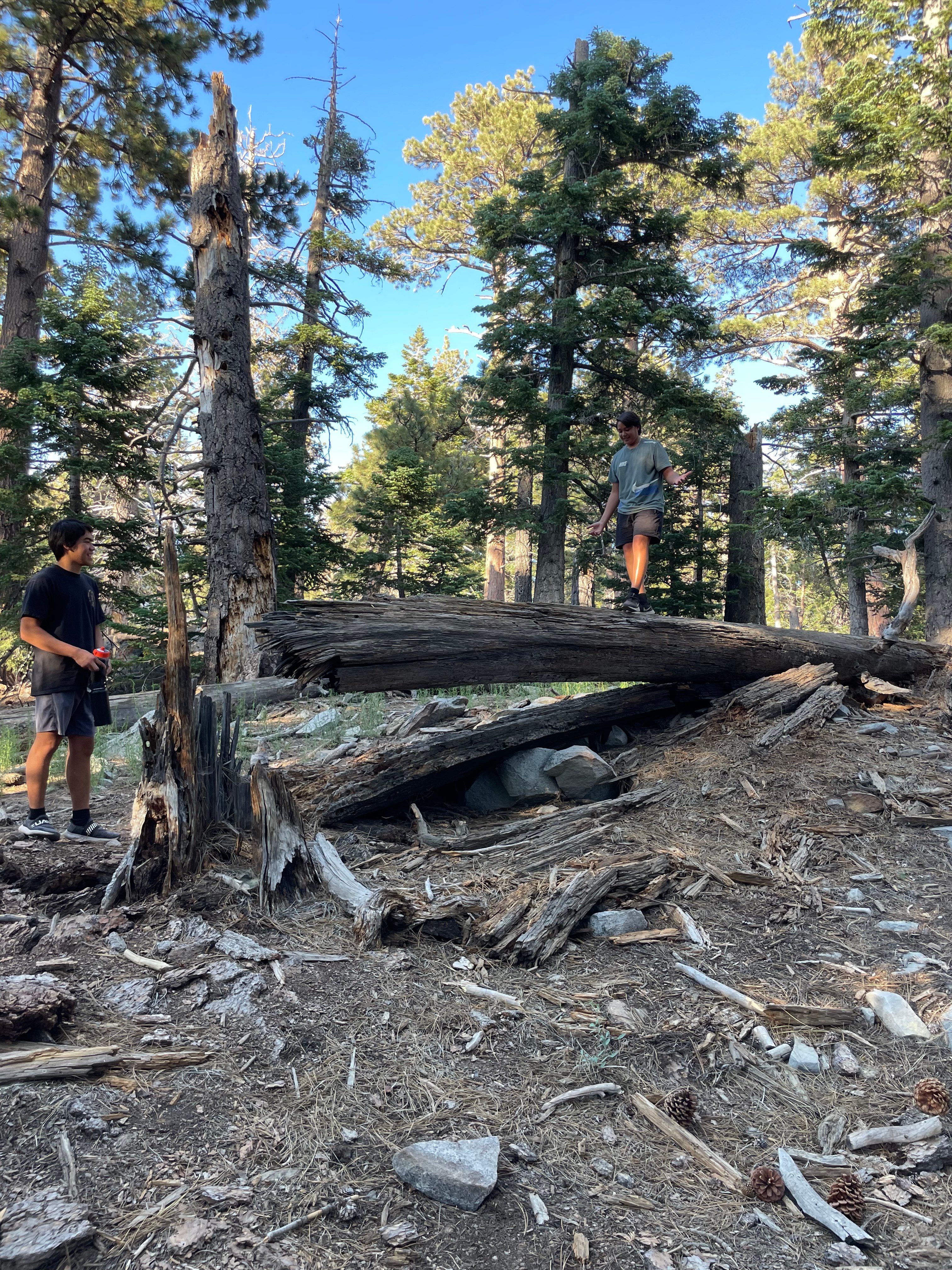
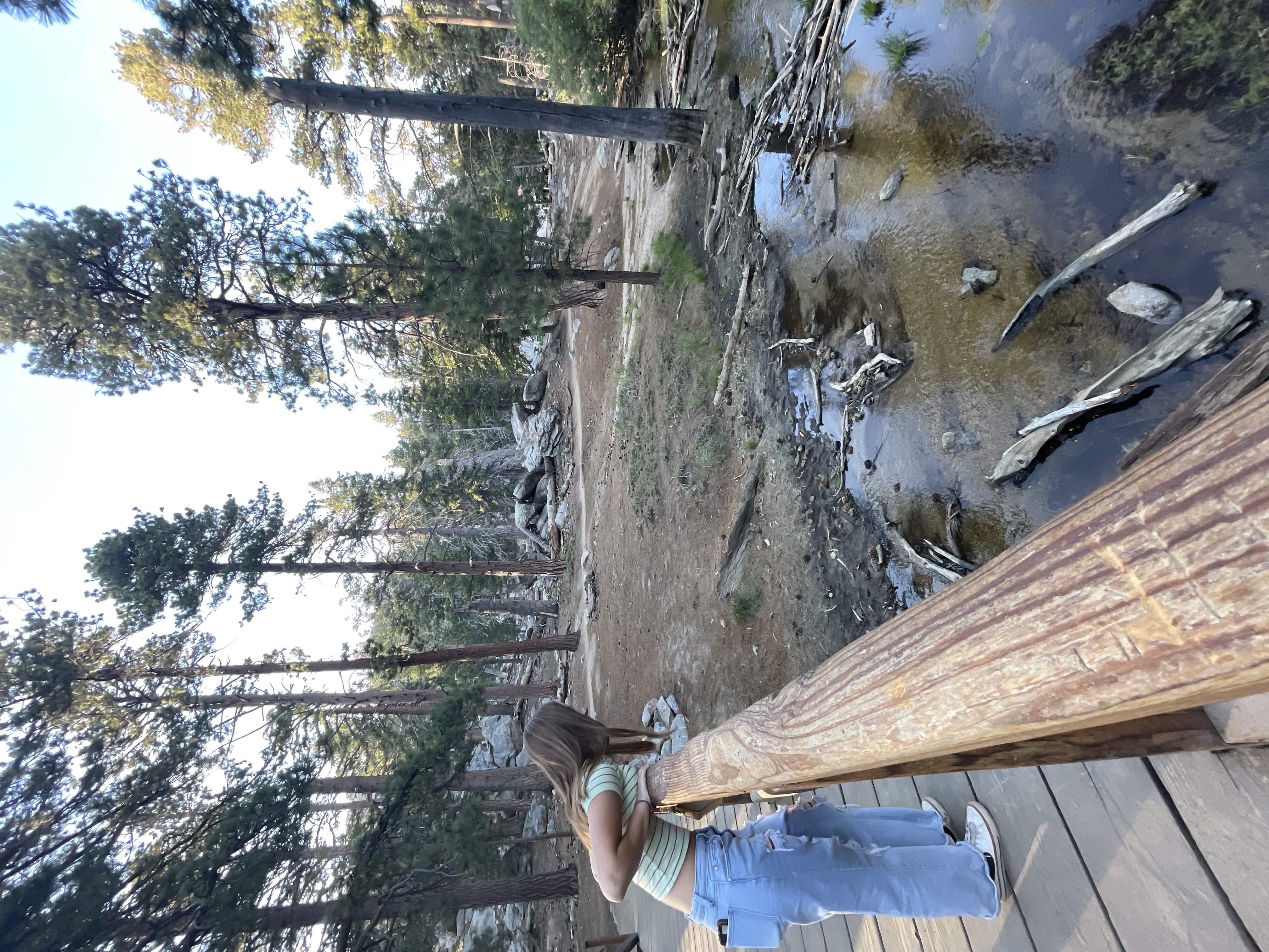
Check out some of the fun we've enjoyed:
 |  |
 |  |
Find all the local trails are on this interactive map!
Temecula Trails
Temecula Creek Trail Park
Right off Butterfield Stage Road. Children's play area along with pathways, lawns, picnic tables & an exercise route.
Vail Ranch Park Trail
Leads from the Vail Ranch Park into some neighborhoods and ends at Pauba Valley Elementary School.
Meadows Park Trails
A little walking trail leads from the park and loops back around.
Harveston Lake
Take a walk around the lake. There is a playground and you can also take a paddle boat onto the lake.
Dripping Springs Trailhead
With 4 connecting trail options, including Dripping Springs, Wildhorse, Palomar Magee, and Cutca, great views of the "Big Four" peaks to the north (Santiago Peak, Mt. Baldy, San Gorgonio, and San Jacinto) as well as wide ranging views of Vail lake, Temecula Valley and open countryside, Dripping Springs provides many great options for the recreational day user. Those looking for overnight camping accomodations after a long day on the trails can cozy up under the stars at the Dripping Springs Campground.
Since these trails typically offer little shade, it is not recommended for the summer months, as temperatures typically hit triple digits. Fall and Spring bring colorful foliage and lovely wildflowers (after the rain) and are considered the best times of the year. Much of the area receives light use, which provides a pleasant and tranquil outdoor experience.
10-30 miles depending on connections. Adventure Pass required or $5 cash. Intermediate level trail. Pets allowed.
The Following Temecula Trails come from the Bike Temecula Valley Website. Make sure to check out the site for more info and a complete map for each trail.
Murrieta Creek Trail
1.5 mi
+44 ft Elevation
Regional Trail
Nestled between Murrieta Creek and Diaz Road, the Temecula section of the Murrieta Creek Regional Trail features scenic picnic areas, and both paved and dirt surfaces. Riders can follow the creek north or cross under the freeway to connect all the way from Old Town to Wine Country.
Temecula Creek Trail
1 mi
+83 ft Elevation
Trail Head
This park located in Vail Ranch is the perfect place to set out for adventure. A one-mile dirt access road leads to branching gravel and mountain biking trails which endlessly crisscross the creek and hillsides.
Wine Country Tour
15.4 mi
+1189 ft elevation
Out and Back
Enjoy this easy e-bike ride on mostly paved surfaces-- great for any fitness level and suitable for all skill levels.
Great Oak Trail
1.8 mi
+101 ft Elevation
Connector
Running along Wolf Creek in southern Temecula, Great Oak Trail is fully-isolated from traffic. Enjoy a short ride/walk to Patricia H Birdsall Sports Park on one end, or to Friendship Park on the other.
Wine Country Ride
16.3 mi
+1,196 ft Elevation
Counterclockwise Loop
Get away to Temecula Wine Country. With an easy portage across the dry creek at Crown Hill, take the road less traveled and leave the traffic behind. Explore the peaceful rolling hills and take a break at your favorite winery.
Pechanga Resort to Wine Country
8 mi each way
+500 ft Elevation
Out and Back
Tour the valley from the Pechanga Resort to the gateway of Temecula Wine Country. This safe route winds through peaceful parks and quiet neighborhood streets.
Midtown Quiet Ride/walk
6.6 mi each way
+286 ft elevation
Out and Back
Enjoy a quiet ride on trails and neighborhood streets, 25-35 MPH, all the way across central Temecula. This route starts at a park on the edge of wine country and finishes in Old Town at city hall, passing by the Rose Haven Heritage garden along the way.
Farmer's Market Ride/Walk
6.3 mi each way
+82 ft Elevation
Out and Back
Join your neighbors on a Saturday morning ride from north Temecula to the Farmer's Market in Old Town. This route follows paved bike trails, separated from traffic. Enjoy a safe ride along the Santa Gertrudis Creek Trail, Santa Margarita Regional Trail, and Old Town Creek Walk.
California Oaks Trail
Multi-use Native Soil 1.0 Miles
Bordered by Jackson Ave to the North and Monroe Avenue to the South, the California Oaks Trail provides a view of the largest aquatic preserve in the City of Murrieta. This trail is joined by Monroe Ave and Jackson Ave to create a 1.0 mile loop around a natural water detention basin full of a wide variety of wildlife animals and native plant materials. There is no water on the trails system and parking is only available on Monroe Avenue.
Cole Canyon Trail
Multi-use Decomposed Granite/Native Soil 3.82 Miles
Escape into the shadows on the Santa Rosa Plateau and enjoy the beautiful scenery of the largest trail in the City of Murrieta. With multiple paths branching off the main trail linking to various neighborhoods and the Copper Canyon Trail, you can explore this area many times and never see the same thing twice. Walk along Murrieta Creek where Native Americans lived hundreds of years ago or access the Santa Rosa Plateau (not part of the City of Murrieta’s trail system) from the northern most point of the trail.
Copper Canyon Trail
Multi-use Decomposed Granite/Native Soil 1.46 Miles
Start off at Copper Canyon Park and make your way from the city into the open wilderness in a matter of minutes. Follow the trail from the lower section of Copper Canyon Park to the upper section, cross Club View Drive and make your way to the “T” in the trail. Bear Valley Park is to the west, or follow the trail back to Club View Drive where you can access the Cole Canyon Trail.
Falcon’s View Trail
Multi-use Native Soil 0.51 Miles
Escape to one of the highest points in the City of Murrieta and see a breathtaking view of the entire Murrieta Valley. Bordered by Tovashal Elementary School to the east and houses to the west, you quickly climb to a viewpoint not known by many. Access is available from California Oaks Road or Nutmeg.
Las Brisas Trail
Multi-use Asphalt 1.14 Miles
Trail access is available from Century Park or Barratt Park off of Las Brisas Avenue and Hancock.Take this easy walk through large eucalyptus trees with a pars exercise course located along the trail.
Lincoln Ranch Trail
Multi-use Decomposed Granite 0.61 Miles
Located off of Whitewood and Carmel Hill, behind Lincoln Ranch, this trail is accessible from many different locations within the housing tract. Walk along this open trail past one of the most beautiful oak trees in the city.
Los Alamos Hills Sports Park
Multi-use Decomposed Granite 1.89 Miles
The trails at Los Alamos Hills Sports Park have quickly become some of the city’s most popular trails. With plenty of parking, drinking fountains throughout the park and a large playground for children, walkers, hikers and runners have come to enjoy using this trail on a daily basis.
Mapleton Trail
Decomposed Granite 1.05 Miles
Located within the Mapleton Housing tract off of Antelope Road and Mapleton Drive, this trail runs through the entire community, running through Mapleton Park and along a long greenbelt.
Murrieta Oaks trail
Native Soil 0.19 Miles
This short but beautiful trail is located off of Murrieta Oaks Road and Clinton Keith.
Pond Park
Concrete 0.29 Miles
Walk around Pond Park and enjoy the sounds of Nature from the city’s only pond. Located on Murrieta Hot Springs Road, just east of Whitewood Road.
Rail Ranch Trail
Asphalt 0.24 Miles
Start off next to Rail Ranch Elementary School, just off of Los Alamos Road and Whitewood, and take an enjoyable stroll through one of the city’s numerous natural open spaces.
Rancho Acacias Trail
Asphalt 0.60 Miles
Located off of Whitewood Road, head south along the trail to Rancho Acacias Park. This leisurely path is a great route used by everyone from runners to walkers to bike riders.
Sycamore Ranch trail
Decomposed Granite 0.72 Miles
Located on Calle de Oso Oro south of Washington Street, this trail runs along a dry creek bed. Head west to the city limits. From there you will eventually reach the Riverside County Trails System.
Toulon Trail or the Frog Hike
Native Soil 0.77 Miles
Accessible from Toulon road, just south of Clinton Keith Road. This trail runs through one of the city’s numerous open space weaving through many beautiful oak trees.
Warm Springs Trail
Native Soil 0.29 Miles
Located within Warm Springs Park off of Whitewood and Alta Murrieta Road, this trail makes a nice loop through a wildlife and nature preserve.
Lake Skinner
Day use: $6 per adult and $3 per child (12 and younger). The Shoreline path takes you along the lake's edge. It's great for beginners and children. It's a dirt path so not great for strollers/bikes. Beautiful views of the lake.
Located at 39400 Clinton Keith Rd., Murrieta, CA 92562The trails have now been reopened after fires destroyed parts of it a few years ago. Click the link above for map with trails in the Santa Rose Plateau Reserve. There are quite a few trails there. Most of the trails are fairly flat but are natural dirt trails. There are reserve fees to use these trails. $4 per adult and $3 per child. There is also a Visitors Center. 9 a.m. to 4 p.m.┃Tuesday - Saturday
Teneja Falls Trail
Enjoy this 1.6-mile out-and-back trail near Murrieta, California. Generally considered an easy route. This is a very popular area for birding and hiking, so you'll likely encounter other people while exploring. The trail is open year-round and is beautiful to visit anytime. Dogs are welcome, but must be on a leash. This trail is also a natural dirt trail that goes uphill in a gentle slope. These falls have had more water in them recently which makes them even more beautiful to see. Some trail goers have gone swimming in the water fall pools. Of course, please proceed at your own risk and use your own discretion when choosing to swim or not swim in the water fall pools.
Menifee Trails
Cross Hike Menifee
An uphill, dirt trail hike behind local park. Make it to the top where the cross is and get beautiful views! 2.4 miles. Dog friendly. May be a little tricky with little ones in tow.
Greer Ranch/Ram Ranch Trail
Right of the 215 Highway between Murrieta and Menifee. If you take the trail to your left, there are many mountain bikers who use this trail so be careful with your little ones as they come down the hill pretty quickly. If you take the trail to the right, it's a flatter trail and more walker friendly. All natural, dirt path trails.
Salt Creek Trail
Paved 5 mile path. Great for biking and for strollers. It goes from Audie Murphy Ranch to Antelope Rd.
Mason Mountain
A quick uphill hike up the mountain with spectacular views. It is a dirt trail and has quite a steep incline so be aware of this if bringing small children.
Heritage Lake Menifee
Take a stroll around the lake. It's a paved path all the way around the lake. Enjoy the view of the water and the ducks that also enjoy the water. There is a little playground along the path around the lake.
Spirit Park
This is a very popular playground for the kids in the area. Lots of fun play structures. There is also a basketball court. There is a very short trail that stems from this park. It starts off paved but becomes a dirt trail. It can be hard to navigate with strollers/wagons especially after a bit of rain.
Kabian Park/Reserve
A beautiful local park with trails branching off from it. It's located near Canyon Lake. Natural dirt path trails. Lots of views of the flowers during the spring.
Are there any local trails we missed? Let us know! Email us at mackidtemecula2@macaronikid.com!
 When visiting events and local businesses, be sure to tell them Macaroni KID sent you... and don't forget to tell all your friends!
 |  |  |